
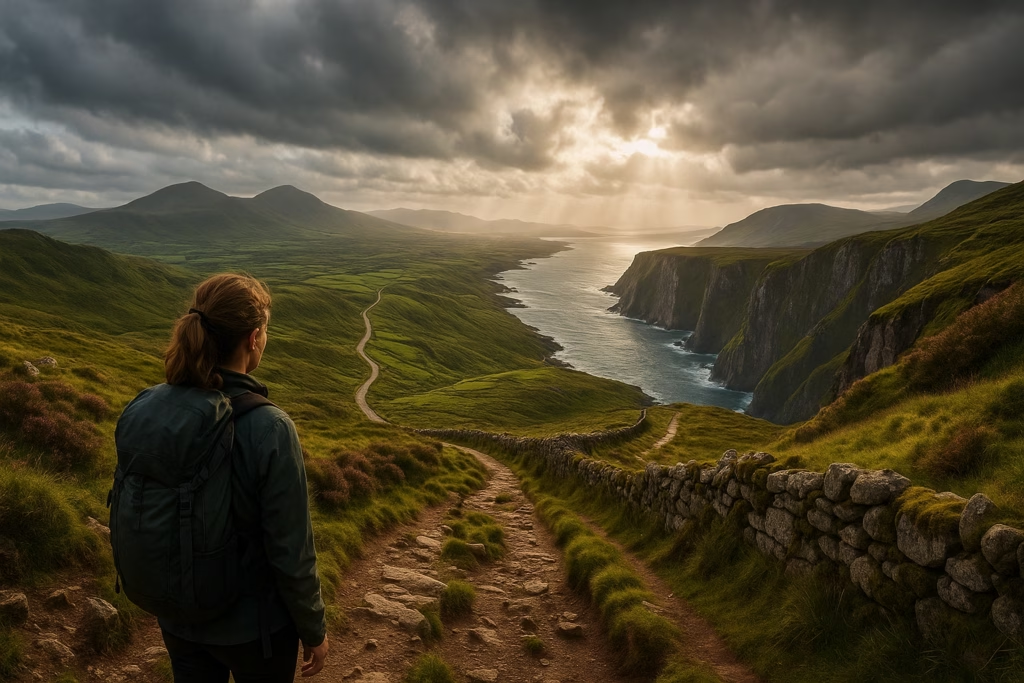
Ireland is a land of rugged mountains, wind-shaped coastlines, ancient pathways, and impossibly green hills that seem to glow after a rain shower. Hiking here is an experience shaped by dramatic landscapes, rich culture, and famously unpredictable weather.
This guide covers the entire island of Ireland, including both:
The Republic of Ireland
Northern Ireland (part of the United Kingdom)
Each region has its own character, history, and trail styles—but both offer unforgettable outdoor adventures for hikers of all experience levels.
➡ Read more: International Hiking Adventures
⛰️ Quick Facts for Hikers
Terrain Overview
Ireland’s trails include:
Rolling mountains and moorlands
Coastal cliffs with Atlantic views
Quiet forest paths
Boglands and highland ridges
Ancient stone walkways and pilgrimage routes
Weather Snapshot
Mild climate year-round
Frequent mist, drizzle, and fast-moving storms
Average temps: 40–65°F (5–18°C)
Strong coastal winds on exposed ridges
Weather can shift in minutes—layers are essential
Two Regions, One Island
Republic of Ireland → Independent nation using the euro (€)
Northern Ireland → Part of the United Kingdom, uses pound sterling (£)
Travel between the two regions is straightforward with no active border checks for most travelers.
Languages
English is spoken everywhere
Irish (Gaelic) in the Republic
Ulster Scots in parts of Northern Ireland
Transportation
Reliable trains and buses between major cities
Trail towns often require local buses or taxis
Rental cars offer the most flexibility
Drive on the left
🥾 Best Hiking Areas in the Republic of Ireland
Ireland’s southern and western landscapes are famous for rugged coastlines, glaciated valleys, and mountain passes shaped by centuries of wind and rain. Here are the top hiking regions in the Republic of Ireland.
Wicklow Mountains – The Garden of Ireland
Top Route: Wicklow Way
One of Ireland’s premier long-distance trails. Expect mountain vistas, peaceful woodlands, heather-covered hills, and the iconic monastic site at Glendalough.
Highlights:
Ancient round towers
Misty lakes
Forest trails
Accessible from Dublin
County Kerry – The Wild Atlantic Heart
Top Route: Kerry Way
Circling the Ring of Kerry, this path features sweeping Atlantic views, lakes, high passes, and charming villages like Kenmare and Glenbeigh.
Highlights:
Iveragh Peninsula
Lakes of Killarney
Dramatic coastal peaks
Dingle Peninsula
Top Route: Dingle Way
A perfect mix of beaches, cliffs, and ancient stone structures. Weather can be wild—but the landscapes are unforgettable.
Highlights:
Mount Brandon
Cliff paths
Celtic ruins and beehive huts
The Burren – Otherworldly Rock Landscapes
A barren, beautiful limestone plateau with rare wildflowers and unique geology. Ideal for shorter day hikes.
Highlights:
Poulnabrone Dolmen
Coastal edges
Spring wildflowers
Connemara – Remote Wild Beauty
A rugged region of boglands, lakes, and quartzite peaks.
Top Route: Diamond Hill Loop (Connemara National Park)
Highlights:
Panoramic Atlantic views
Quiet, remote trails
Unique light and weather shifts
Slieve Bloom Mountains
Gentle mountains perfect for less strenuous day hikes. Forest loops and ridge traverses offer peaceful walking.
Croagh Patrick – Ireland’s Pilgrimage Mountain
A steep climb overlooking Clew Bay. Best done in clear weather due to loose rock near the summit.
🥾 Best Hiking Areas in Northern Ireland (United Kingdom)
Northern Ireland’s trails combine rugged coastlines, volcanic formations, quiet farmlands, and granite peaks framed by the Atlantic winds.
Causeway Coast Way
Up there with Scotland’s coastal routes, this trail offers breathtaking cliffside walking.
Key Sights:
The Giant’s Causeway
Carrick-a-Rede rope bridge
Basalt cliffs and sea arches
Mourne Mountains
Granite peaks surrounded by dramatic ridges and valleys.
Top Route: Slieve Donard (NI’s highest peak)
Signature Feature:
The iconic Mourne Wall, stretching 22 miles across the mountains
Sperrin Mountains
Remote, windswept moorlands perfect for solitude and wide-open views.
Cuilcagh Boardwalk (The “Stairway to Heaven”)
A carefully constructed wooden boardwalk rising over boglands to panoramic views.
Antrim Hills Way
An underrated long-distance trail with rolling hills and ocean vistas.
🌦️ Weather & Seasonal Trail Conditions
Spring (March–May)
Cool temps, greener landscapes
Occasional heavy rain
Great shoulder season for popular trails
Summer (June–August)
Mild, comfortable temps
Longer daylight hours
Still expect rain—this is Ireland!
Autumn (September–October)
Crisp air
Lower crowds
Excellent visibility for mountain and coastal hiking
Winter (November–February)
Wet, windy, and dark
Low-level walks preferred
Storms possible along the Atlantic coast
Important Note
Ireland’s weather is famously changeable. Always check:
Met Éireann (Republic of Ireland)
Met Office UK (Northern Ireland)
🧭 Navigation, Terrain & Safety Tips
Trails can become muddy and slick after rain
Fog and mist can reduce visibility quickly—carry GPS or maps
Waterproof jackets & boots are essential
Some paths cross farmland → follow access signs and close gates
Trails may involve steep steps, rocky footing, or exposed ridges
Cell service can be patchy in mountain regions
🦌 Wildlife, Plants & Natural Features
Expect a mix of:
Wildlife
Red deer
Hare
Fox
Seabirds (gannets, puffins, fulmars)
Coastal marine life
Flora
Heather
Wild ferns
Coastal grasses
Spring wildflower blooms
Moss-covered forests
Landforms
Sea stacks & basalt cliffs
Glacial valleys
Highlands and rolling hills
Windswept boglands
🕍 Cultural & Historical Highlights on the Trails
Ireland’s historic past is everywhere. You’ll often encounter:
Medieval monasteries
Round towers
Celtic stone circles
Ancient forts
Country lanes dating back centuries
Cliffside ruins
Pilgrimage paths walked for generations
These elements give Irish hikes their uniquely mystical feel.
🗺️ Maps, Guides & Navigation Tools
For the Republic of Ireland
Ordnance Survey Ireland (OSi) maps
EastWest Mapping (detailed 1:25,000)
Waymarked Trails Ireland (official routes)
For Northern Ireland
Ordnance Survey UK (OSNI)
WalkNI trail guides
NI Environment Agency maps
Digital Tools
AllTrails
ViewRanger
Gaia GPS
Mapy.cz
Google Maps offline downloads
🌦️ Trail-Side Weather Resources (Quick Links Table)
(I can build the HTML table next with trail towns if you’d like.)
For now, here are the official sites:
Once you decide which towns or starting points to highlight, I’ll build the full weather table in your usual Hiking Equipped format.
🧭 Essential Ireland Travel Tips for Hikers
Money
Republic: euro (€)
Northern Ireland: pound sterling (£)
Many businesses accept cards everywhere, but rural areas may use cash more frequently.
Transportation
Rail and bus connections to most cities
Rural trailheads often require taxis or rental cars
Expect narrow rural roads
Store Hours
Shops often close earlier than in North America
Sunday hours can vary by region
Connectivity
SIM cards: Vodafone, Three, Eir
Wi-Fi widely available in towns
Patchy service in mountains
Emergency Numbers
Republic of Ireland: 112 or 999
Northern Ireland (UK): 999
🌈 Final Thoughts: Why Hike in Ireland?
Ireland offers landscapes that feel ancient, alive, and shaped by stories older than the trails themselves. Whether you’re trekking along the Atlantic coast, climbing windswept peaks, or wandering quiet valleys filled with mist and stone, hiking here connects you to nature in its most dramatic and poetic form.
Let the island’s wild beauty guide your steps—and discover why Ireland remains one of Europe’s most soulful hiking destinations.
🧭 Trail Comfort Tip: Restrooms on Ireland’s Uplands
Ireland’s Wicklow Mountains, Connemara, and bogland regions are wide-open landscapes with few restroom facilities on the trail. It’s normal for hikers to step away from the path, using dips in the land, tall grasses, or ridgelines for privacy. Follow Leave No Trace guidelines by moving at least 70 meters (200 ft) from trails and water, and packing out all toilet paper. Trailheads near towns and car parks often have facilities before your hike begins.