
Maps & navigation apps for international hikers and knowing where you’re going is more than just a convenience — it’s a matter of safety. Trails abroad may be well-marked in some countries and nearly invisible in others. Relying on a single app or map can leave you vulnerable if the battery dies, the weather closes in, or cell service disappears.
Whether you’re navigating Scotland’s foggy Highlands, Spain’s Camino routes, or Canada’s remote backcountry, having the right mix of paper maps, navigation apps for hikers, and local knowledge will keep your hike on track.
➡ Back to: Hiking Scotland → Practical Travel Logistics → Maps & Navigation
Why Maps & Navigation Apps for International Hikers Matters Abroad
- Unfamiliar Terrain – International trails often cross private land, farmland, or unmarked wilderness.
- Variable Markings – Some countries have clear trail systems; others rely on cairns or no markers at all.
- Safety Risks – Getting lost can delay rescues, increase exposure, or cause serious injury.
- Technology Gaps – Phone service and GPS reliability differ by country and terrain.
Best Paper Maps for International Hikers
Scotland & UK – Ordnance Survey (OS) maps are detailed and highly reliable.
Spain – IGN maps cover national parks and Camino routes.
Canada – National Topographic System (NTS) maps are the gold standard for backcountry navigation.
👉 Always waterproof your paper maps or carry them in a sealed map case.
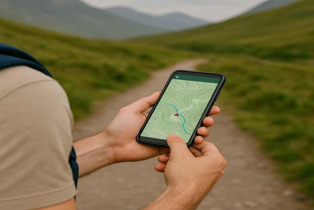
Top Maps & Navigation Apps for International Hikers
- Gaia GPS – Excellent for offline maps, route planning, and tracking.
- Komoot – Popular in Europe; integrates with cycling and hiking routes.
- AllTrails – Good for user-shared routes, but less reliable in remote areas.
- OS Maps App – Essential for hiking in Scotland and the UK.
- MAPS.ME – Handy for urban + rural use with offline detail.
Safety & Backup Strategies
“Even the best navigation apps for hikers can fail without signal or power, which is why paper maps and compass skills are essential.”
Always Carry Both – Pair digital apps with paper maps for redundancy.
Extra Power – Bring a charged power bank or solar panel (see [Electricity & Device Charging]).
Practice Before You Go – Learn to use a compass with paper maps. Technology can fail; analog skills don’t.
Local Knowledge – Ask locals, rangers, or hostel owners about current trail conditions.
Real-World Example: Hiking in Scotland
On the Cape Wrath Trail, there are no official waymarks. Most hikers rely on OS maps combined with GPS apps like Gaia. Fog and rain often reduce visibility, so a paper map and compass are essential. Relying solely on AllTrails would be risky — the terrain is too remote and unpredictable, and only the best navigation apps for hikers can offer reliable backups.
Conclusion
Navigation abroad isn’t just about choosing the right app — it’s about layering your tools. Combining paper maps, offline navigation apps for hikers, compass skills, and local advice ensures you’re prepared for any trail.
So, whether you’re in Scotland’s Highlands, Spain’s Camino towns, or Canada’s Rockies, remember, navigation apps for hikers are powerful tools, but they work best when paired with backups. Plan ahead, and you’ll never truly be lost.